Trying to decide if you should hike the Tongariro Alpine Crossing? Here's the long read. From grit to grandeur, from Mo who's spent 30 years guiding this trail. How busy? How tough? Best time? How do the shuttle buses work? He gives you a unique set of facts to help you make a good decision.
The Tongariro Alpine Crossing: Is It Worth the Hype?
Yes, the Tongariro Alpine Crossing deserves its 'must do' reputation. It's like hiking a miniature piece of Bolivia's volcanic Altiplano: brilliant charcoals, ochre reds, immense skies pierced by volcanoes, absurdly coloured lakes, and the realisation that the earth is breathing and heaving beneath your feet. It's totally worth the hype!
Curiously, many New Zealanders are dismissive of the Tongariro Alpine Crossing because, on a fine day, there are occasionally crowds of a thousand or more on the track. But that's a strong Kiwi view of what makes a hike enjoyable. Anyone who's spent time in the national parks of North America, Europe, Wales, or places like Table Mountain in Cape Town is familiar with these sorts of numbers.
Some advice: don't rush it, especially if your car's parked conveniently at the end. Meeting a shuttle? Use the track times to work out roughly when you need to reach the car park, then once at the summit spin your day out accordingly – unless sitting in a dusty car park waiting for a shuttle appeals. The trail is a much nicer place to waste time.
We also hike the Tongariro Alpine Crossing as the finale of our multi-day hike across the Tongariro Northern Circuit, on our small-group trips, and it's a completely different experience. Spend two quiet days on the Northern Circuit exploring the mountain's wilder eastern flanks before emerging blinking onto the Crossing at Emerald Lakes, giving you the best of both worlds. Remote and astonishing, and then walk 'backwards' out to Mangatepopo road end!
What to Expect on the Walk, a description of the track
The set direction is from Mangatepopo road end in the west, at 1,120 metres, through the South Crater between Mounts Ngāuruhoe and Tongariro, climbing to the high point on the lip of Red Crater, and then down down down past the old Ketetahi Hut site to the bush and the road end at 760 metres. This direction means less climbing than walking it the other way. Have a look at the Mountain Safety Council YouTube for timings, hazards, weather, and gear.
The Tongariro Alpine Crossing is challenging, but not quite in the way people imagine. Only about a third of the day involves the rough volcanic terrain that many imagine when they think of the Crossing. There is remarkably little wasted climbing on the Crossing. Almost every metre you climb buys you altitude, rather than losing it again around the next corner. It is challenging on several levels: the distance, the exposure to the elements, the altitude gain, and a long descent that tests different muscles. This descent has a faintly Sisyphean quality too; progress underfoot with no apparent nearing to the car park – especially those infuriating zigzags!
The best way to describe this walk is the rule of thirds.
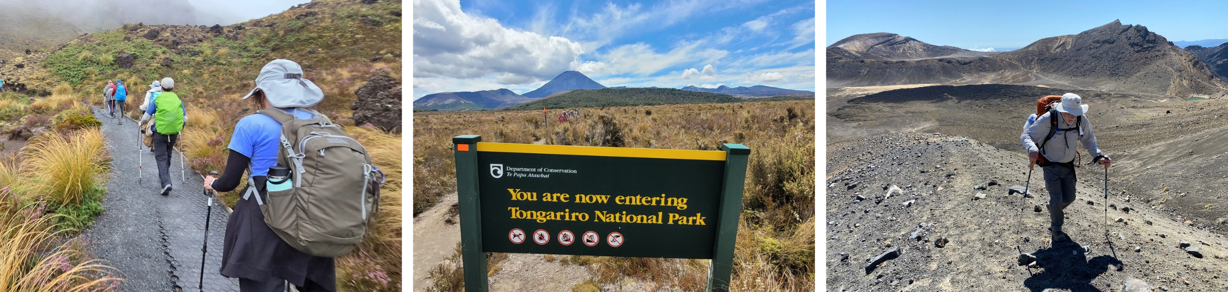
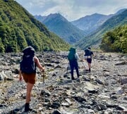
The first third steadily ambles up a broad valley on a well-formed track to the base of a significant steep climb up the headwall known as the Devil's Staircase (90 min). This steep but well-engineered trail with plenty of stairs eventually sidles across to the edge of the dead flat South Crater (45 min). Underfoot there are some slabs of stone made into steps, a little bit of rocky stuff, but generally very well-formed, especially in the valley. Quite a few people walking this easy valley section are simply doing the return walk to Soda Springs, so the first bit of this one-third can be a little busier here later in the mornings.
The middle third is the truly spectacular alpine section. The trail surface varies from dead-flat across clay pans (South Crater) to sidles beneath crags on skatey, slippery clay to sections of deep loose scree (both climbing and descending Red Crater lip). From Emerald Lakes the track is generally well formed again, despite still being high and exposed in the alpine zone. From the Blue Lake toilets, the generously graded track descends, passing the odd washout and damage from winter avalanches. It plugs on towards the old Ketetahi Hut site in a succession of infamous zigzags; some so horizontal that you begin to wonder whether someone lost the plot in a white-out when they built it.
Hikers string out more on this middle section so it's not as crowded, even on those big days. But on a no-wind day at Emerald Lakes people rightfully linger. A picnic at Emerald Lakes? Think Central Park, but with volcanoes.
The final third from the old hut site is an exceptionally well-made trail. Ironically, although it's the easiest section technically, the hard, compacted surface and thousands of step-downs are tiring. I sometimes take (mountain) running shoes for this section. Steady but mostly not steep through waving tussock lands, then after about forever, a short sharp descent over the toe of an ancient lava flow and into the welcome shade of the forest, 15 min of steepness and back to gentler trail to the end.
Scenery That Lives Up to the Reputation
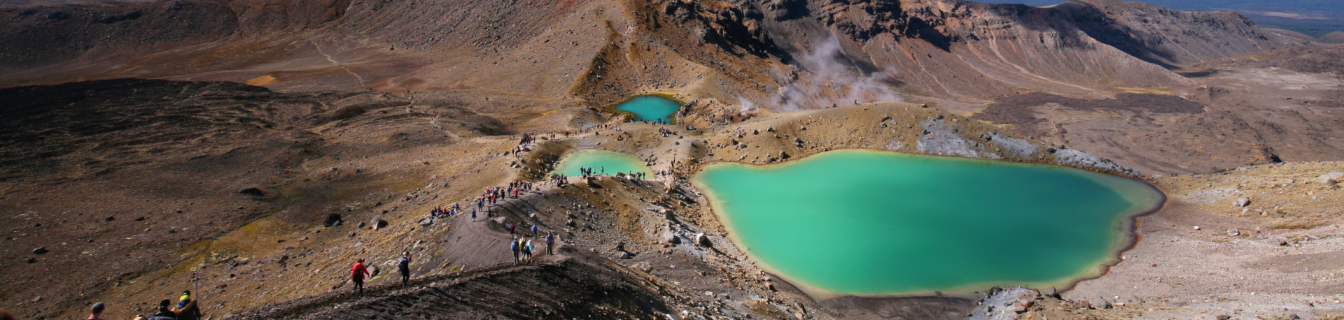
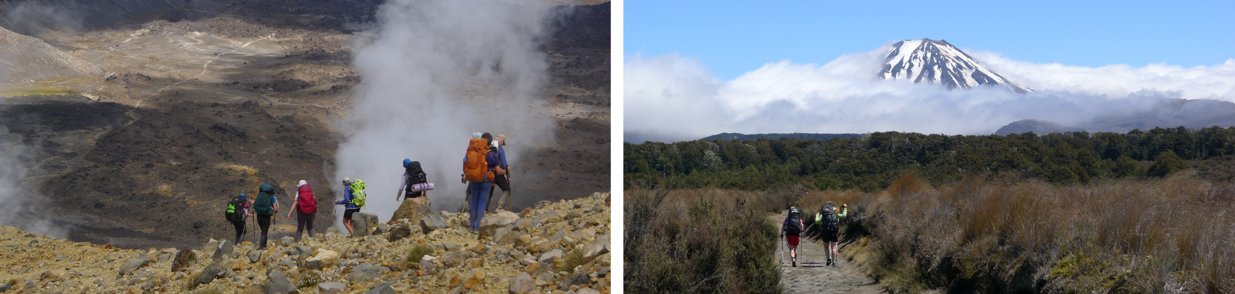
It's easy to get a bit giddy about the scenery concentrated in that middle third. Not that the first third isn't spectacular too, but the middle is the secret sauce: a volcanic moonscape of contorted lava flows and ash fields, Red Crater, those ridiculously coloured Emerald Lakes suddenly appearing. Lava valleys, scarlet moonscapes, steaming craters make it feel wonderfully otherworldly, and starkly different from almost any other hiking in New Zealand. It is easy to see why it is considered the best one-day walk in the country. And why it's rightfully a bit busy.
There is also more mana to the place than the scenery alone suggests. Tongariro is New Zealand's oldest national park (tuku and intended partnership from local Māori with the Crown in 1887), and the fourth oldest in the world. In 1993 it became a UNESCO mixed cultural and natural World Heritage Site, recognition that this is a remarkable landscape in more ways than one. BTW if you are wondering where that famous photograph of the Emerald Lakes is taken from, it's a few metres into the descent (just after the high point at Red Crater), at around the halfway point of the Crossing. It really is quite the spot. The ochre-red scree slope makes the descent look rather more intimidating than it is, but take your time and choose your footing.
A Word on the Mountain's Significance
Ngāuruhoe and Tongariro hold deep cultural significance to Ngāti Tūwharetoa and Ngāti Hikairo ki Tongariro, who consider the peaks to be ancestors. Since 2017, DOC has removed trail markers on the routes to the summits and worked with local iwi to discourage visitors from climbing them, a request worth respecting. Local iwi have asked visitors to refrain from referring to Ngāuruhoe by its film name, Mt Doom. None of this changes how the Crossing itself is walked, but it adds a layer of meaning to this wonderful place.
How Busy Does It Get?
I've been guiding here for the last 30 years and walking it for 20 before that (that's a little confronting). It is busier now than in the early 2000s. Other than the first fine weather day after a week of grimness, the usual busy periods are Easter and the Christmas to early New Year period when we Kiwis are all on holiday. On these occasions, get ready for a long line, especially for the first hour or so.
New Zealanders can be quick to dismiss the Tongariro Crossing because on those days it can feel really busy. Personally, I think that's a bit unfair as the rest of the time I don't find it markedly busier than popular sections of the Abel Tasman, the Hooker Valley Track, or even Blue Pools. And from an international perspective, the numbers are hardly remarkable. Anyone who has walked in places like Zion, the Grand Canyon, or popular parts of the Swiss Alps probably won't need to have a tantrum. This is also a through walk, not a return trail, so you only ever contact a fraction of the other hikers on a given day.
People are friendly. Kind words are exchanged, someone offers water (why don't we offer brandy anymore!) to a stranger who has run out, and there's a humanity here, and everyone shares the same appreciation of this extraordinary place. You may find yourself walking alongside a stranger for 20 minutes, exchange emails, and suddenly have somewhere to stay when you are next in the Faroe Islands. Of course, you might run into the odd muppet or drone flyer that the rangers haven't neutralised yet, but that can happen anywhere. If solitude matters enormously to you, leave at noon, take a headlamp in case, (make sure your car is at the other end), and finish at 7 pm (tell the car park warden when you park so they won't worry).
Most people depart from the road end in that 7:00am–9:00am window, creating that pulse that gradually stretches out along the track into chattering clumps of happy hikers! Everyone is travelling in the same direction, so over six to eight hours you cross paths with only a fraction of the people walking that day.
Beyond the Crossing: The Tongariro Northern Circuit
The Tongariro Northern Circuit is a 3-day loop walk around the northern half of the national park (not Ruapehu, the biggest volcano), with around two-thirds of the Tongariro Alpine Crossing being part of this multiday trail. But a 10-km section of trail connecting Whakapapa (traditional start or finish) with the first other road access (Mangatepopo) remains closed. The Tongariro Northern Circuit (as of 2026-2027) needs to be completed as a "C", not a loop trail. See FAQ below.
Why spend three days walking the Tongariro Northern Circuit instead of just hiking the Crossing?
You sleep on the mountain rather than just visiting it. Walking this magnificent 3-day section lets you experience Tongariro at a different pace. Walk in through the quieter, drier eastern side of the park where there's time to sit on a rock, look out across a landscape that has scarcely changed in human memory, and feel pleasantly insignificant for a while. There's no bus to catch and nothing much to do except just be there. Staying in the huts is social and relaxing, and as only about 40-50 people can stay in huts or camp, that's all you will see, even on the busiest days.
Walking the Northern Circuit
On our small-group 8-day Ultimate North Island adventure, we do this hike. We usually go anti-clockwise. The first day heads eastwards, gently up through open tussock lands and across the low saddle between Ruapehu and Ngāuruhoe to Waihohonu Hut, a DOC hut beside a stream and a grove of mountain beech forest. From there, a shorter day crosses ash-moraine ridges and stony desert, with a remote lake detour or the clear waters of Ohinepango Springs, before arriving at Oturere Hut on the edge of an old lava flow beneath Ngāuruhoe. On the third day you climb up to Red Crater and Emerald Lakes, joining the Alpine Crossing for its final spectacular push over Red Crater summit and covering what is the first half of the Tongariro Alpine Crossing (now in reverse).
With two unhurried days, your guide can share the geology, ecology, and cultural stories of a place with deep significance to Ngāti Tūwharetoa and Ngāti Hikairo ki Tongariro. It is a genuinely different way to experience one of New Zealand's most iconic landscapes, and for hikers with time, we think it's the better one.
Why We Recommend Going Guided (as we would!)
Leave the logistics to us. The Crossing is a point-to-point walk, so independent walkers' transport needs organising before you start. On a guided trip, the transport, accommodation, and other arrangements are already taken care of. You turn up with your boots and day pack and concentrate on the walking. There is also the question: is the weather safe enough today? Your guide will make that call.
Safety and experience. The Tongariro Alpine Crossing has the highest number of search and rescue callouts of any track in New Zealand. Underestimating the time required, insufficient fitness, and injuries all contribute. An experienced guide knows the terrain, watches the weather closely, and, perhaps most importantly, sets a pace appropriate to both the conditions and the people walking that day. Guided operators also work under different protocols when a Tongariro Alpine Crossing weather advisory is in place. Rather than automatically abandoning the mountain altogether, an experienced guide can assess the conditions on the ground and, where it is safe to do so, explore part of the route before turning back. A poor-weather day need not therefore mean no time on the mountain at all.
Someone who knows. There is considerably more to Tongariro than spectacular scenery. A good guide can read the landscape as you move through it, explaining the geology, ecology, cultural history, and stories that give the place context. Lava flows become eruptions rather than just black rock; steaming ground tells you something about what is still happening beneath your feet. There is also value in knowing when to stop and look, and when to keep moving. A guide who knows the Crossing knows which places deserve lingering over, when it's better to put your head down and stride, and occasionally, "There's a much more comfortable rock just around the corner!"
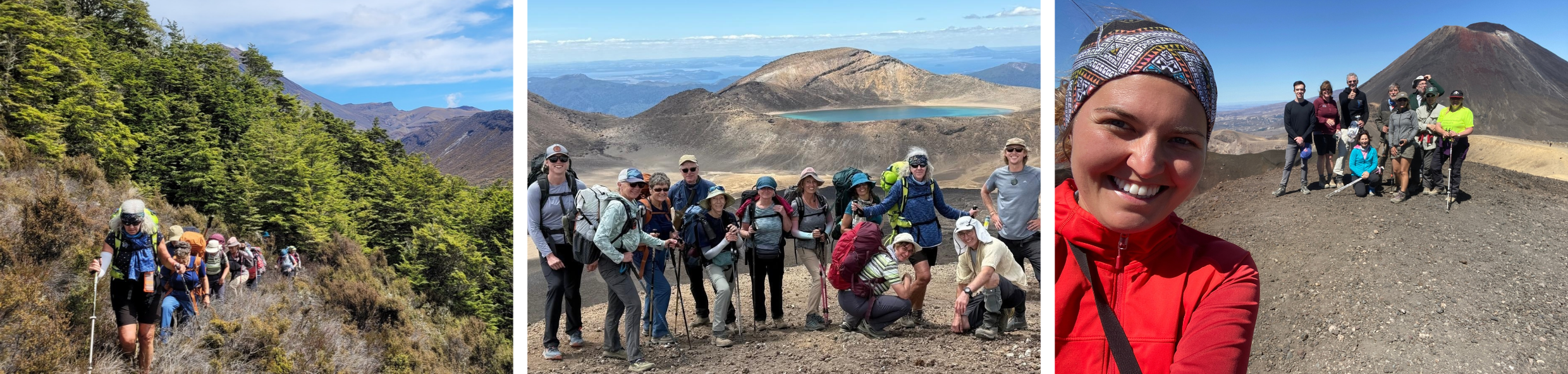
Good company. There's something rather nice about walking with a small group of people who have all chosen to spend their day doing the same hard thing. Conversations come and go along the track, people look out for one another, and reaching the high point together gives everyone the same buzz. There's something to be said for doing it alongside a small group of like-minded hikers: the shared sense of achievement at Red Crater, the conversation over dinner at Waihohonu Hut or back at the hotel if you are a day walker, and the friendships that tend to form on a multi-day trail stay with people long after the trip ends.
Getting Ready for the Day
Get fit for the distance, height gain, and rougher sections of walking. See our FAQs for more on fitness and what to carry, but good, comfortable boots matter. Hot feet = blisters. As Ange, our sales and customer service lead, discovered, getting your coffee-drinking and chocolate-eating skills up to scratch doesn't count as training, however tempting that is to believe. If you're walking the Crossing as part of a three-day trip, you'll need a higher level of fitness than for the day walk alone. You'll be carrying a pack and covering considerably more distance over consecutive days.
Bad weather advisories
DOC issues bad weather advisories for the Tongariro Alpine Crossing, and shuttle companies cannot operate while one is in place. These are usually known by the evening before, giving walkers time to change their plans. Going beyond an advisory requires experience, equipment, and judgement. Take it seriously. It's there for a reason.
The terrain itself is seldom the greatest danger. An injury or navigational mistake can leave someone stationary in cold, wet, and wind. Hypothermia is the real danger. New Zealand alpine weather can deliver temperatures just above freezing with rain, sleet, and strong winds. Most skiers would rather stand around at minus 20°C in dry air than plus 5°C in driving rain. Cold and wet is a horrible combination.
Nature isn't your friend and it isn't your enemy. It simply gets on with being nature. The mountain will do today exactly what it was going to do whether you're on it or not. Your only choice is whether today is the right day to be there.
Can I walk in winter?
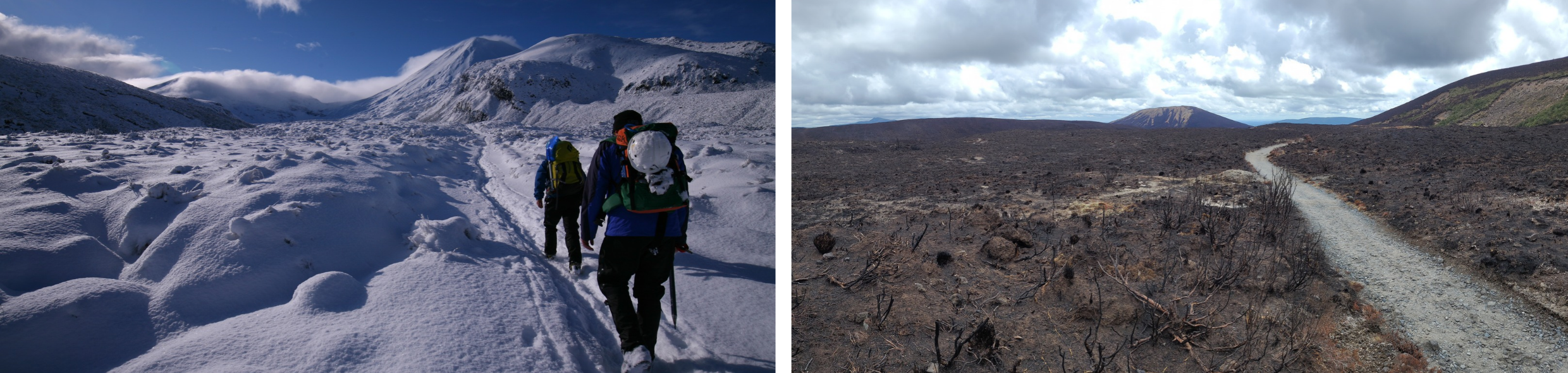
Winter isn't a calendar date; it's when conditions on the track move to snow and ice, either temporarily or for the winter months, usually from May or June through to early October. Slopes that are straightforward in summer can become steep snowfields or sheets of hard blue ice. At 39 degrees south, these volcanoes sit roughly at the latitude of Lisbon or Athens, so winter conditions can alternate repeatedly between freezing and thawing. Warm fronts melt the snow, which then refreezes to ice, more hazardous than fresh snow. Depending on the conditions, crampons, an ice axe, and occasionally a rope may be needed to travel safely. This is no longer a simple hiking track.
The good news is that winter on Tongariro can be spectacular. On the right day, with stable snow and good weather, it becomes one of New Zealand's great alpine experiences. Several local guiding companies operate winter trips, and we'd strongly recommend joining one if you want to experience the Crossing at this time of year. On a good day, it is arguably one of the best ways to walk the Crossing.
Quick Facts
-
Distance: 19.4 km
-
Highest point: Red Crater, 1,886 m
-
Walking time: Six to eight hours at a steady pace
-
Water: No drinking-water supply on the track or at either end
-
Rubbish: No rubbish bins. Take everything out with you.
-
Toilets: At the start and finish and roughly every couple of hours, except through the middle section, where there can be two to three hours between loos.
-
Drones and speakers: DOC prohibits drones and loudspeakers on the Crossing while people are walking. If you come across someone who seems unaware of that, feel free to educate them. We certainly do.
-
Mobile phone coverage: Coverage has improved remarkably since 2025. One NZ and Spark now provide good coverage through the starting valley and during the final hours of the walk, although you won't have reception everywhere. Older guidebooks and websites may say there's no reception at the Ketetahi end. That's no longer true (2026). But mobile coverage is only useful if you haven't dropped your phone in a stream, soaked it in the rain, or flattened the battery taking photos of Emerald Lakes.
Frequently Asked Questions
Do I need to book to do the Tongariro Crossing?
Yes. On the Department of Conservation website, they ask you to book. There's a simple form to fill out. If you Google DOC book the Tongariro Crossing and have the patience to click the same button a couple of times, you'll get here. At some point numbers per day will be limited, but currently (2026-2027) they're not.
Where is the best volcanic activity to view on the Crossing?
The most recent eruptions were at Te Māri in August and November 2012. Towards the end of the middle third of the trail, as you descend towards the old Ketetahi Hut site, look east and you can see the crater and the path of the pyroclastic flow heading down the valley. Steam vents are visible around Emerald Lakes, one noisy vent on the east side of the biggest lake, and on the summit of Red Crater (north end) you can scratch aside loose rock and feel warmth in the ground beneath (look for the white precipitate). In clear weather, you also see a steam vent near the northeastern summit of Ngāuruhoe. On warm days, steam vents are much less noticeable.
Is the Tongariro Alpine Crossing worth doing despite the crowds?
Yes. Around 100,000 people walk the Tongariro Alpine Crossing each summer season. That sounds like a lot, but more than 300,000 people climbed Angels Landing in Zion in 2019, while popular walks around Lac Blanc in Chamonix and Tre Cime in the Dolomites can see thousands of walkers on a busy day. By international standards, Tongariro really isn't unusually crowded. On a fine day, there can be a busy morning pulse, but people gradually spread out. If solitude matters, walking the Northern Circuit gives you more control over when you join the Crossing and lets you avoid the main flow of day walkers.
Do I need to go guided to walk the Tongariro Alpine Crossing?
No. Thousands of people walk the Crossing independently. A guide adds local knowledge, weather judgement, first aid and emergency support, and takes care of the transport logistics. For many people, the biggest benefit is simply having someone experienced making the decisions, leaving you to enjoy the walk.
Can I do the Tongariro Alpine Crossing as part of a multi-day hike?
Yes, and we think it's the best way to experience it. The Tongariro Northern Circuit approaches from the quieter eastern side of the park before joining the Crossing near Emerald Lakes. Our Ultimate North Island adventure does exactly this, while our Tongariro Hike and North Island Grand Hikes also include the Crossing as part of a longer itinerary.
Which direction should I walk the Crossing?
Almost everyone walks from Mangatepopo in the southwest to Ketetahi in the north. There's no rule saying you have to, but the shuttle system and national park protocols are set up around this direction. Mangatepopo also starts higher, so there's less climbing overall. With no visitor parking at the Mangatepopo road end and the shuttles expecting you to travel this way, there are plenty of good reasons not to fight the system.
What should I pack for the Crossing?
In summer, take a couple of litres of water (soda bottles work well as extras), a raincoat, warm thermal layers, sunblock, and a hat. Feel happy if most of the warm clothes and rain gear stay in your pack all day. But in this national park, the weather rarely reads the weather forecast.
What's at the track start and finish?
Both road ends have basic toilets. The Mangatepopo start also has a shelter, which is rather more architecturally splendid than it is practical for either rain or sun. At Ketetahi, there's a much more effective shelter from both, along with basic toilets.
The walking track finishes at the shuttle bus park, not the private car park. There's an annoying one-kilometre walk down a dusty gravel road. It's a slightly tragic way to finish the best one-day hike in the country. DOC has built a small footpath, unfortunately on the sunny rather than the shady side of the road. You can sweat and then get covered in dust on the right day.
Where do I park or how does the shuttle work?
It's about a 30-minute drive to the start or finish from the closest accommodations, and as almost everyone walks in the same direction, shuttle operators will pick you up from your accommodation, drop you at the start, then collect you at the finish. Most offer alternative pickup times.
If you have a vehicle, you can park at one of the two private car parks at the finish point (look online for Ketetahi park or park and ride) and take their bus to the start. That removes any pressure to exit the trail by a particular time. Most accommodation providers have a preferred shuttle operator. If you're booking independently, ask your accommodation who normally services them and just use that company. It keeps the logistics pleasantly simple. So don't sweat it. These are mostly small, independent mum-and-dad shuttle companies, run by kind, helpful people who want your business. Don't overthink the logistics. It will work itself out when you're closer.
What happens if I book a shuttle but have to turn around? How do I get back to my accommodation?
Shuttle operators are used to people who have to turn back because of illness, injury, or weather. With OK mobile reception at the road ends, it's generally straightforward, but make sure you know your shuttle company's instructions and conditions for this situation before you set off (and if you can call their free phone or use WhatsApp, etc.). If you return to Mangatepopo way early, there's a public hut about half an hour up the track which is a more comfortable place to stooge. (The hut is marked as no day walkers, but if you're limping back because of illness, injury, or some other genuine problem, just hang there.)
I've missed my shuttle from the end. What happens now?
Get in touch with your shuttle operator ASAP. You're going to know you are late ages before you're late, so give them some advance notice. Often, they'll wait a bit. The important thing is to keep your shuttle operator informed.
Was there a major fire in 2025 that closed the trail?
Yes, and some non-Tongariro Alpine Crossing sections are still closed (2026-2027). A scrub and grassland fire (3,000 ha) near the Mangatepopo road end in Nov 2025 briefly affected access to the Alpine Crossing but did close the 10 km Northern Circuit link trail (between Whakapapa and Mangatepopo). Affectionately known to locals as 'the Ditch', this section is sometimes skipped (if you have another way of reaching Mangatepopo road end). The Ditch is still closed (as of spring 2026), and DOC says it will be closed at least till mid-2027. This makes the Tongariro Northern Circuit an "open-jaw" or "C" shape for the next season (or two?). This does not affect the Tongariro Alpine Crossing. See this updates page.
Can I walk the Crossing alone?
It's not advised, but on a fine summer day you're unlikely to be alone. Plenty of people walk the Crossing by themselves, and there will usually be other hikers around. If you do go solo, start reasonably early, carry a working mobile phone capable of calling 111, and don't be afraid to ask other hikers for help. People are remarkably willing to look after one another on the trail. In poor weather, it's a different proposition. Setting out alone in bad conditions would, in my view, be nuts.
Do I really need hiking boots, or are running shoes okay?
Boots versus shoes can be surprisingly polarising. Running shoes are workable in summer if you don't mind some occasional misery: wet feet through puddles, stones getting into your shoes on the scree, and less grip on the firmer scree sections. Trail-running shoes or boots are much better suited to the terrain. For avoiding a rolled ankle, the width and stability of the heel platform can matter more than how high the footwear comes up your ankle, in my experience. If there's snow, wear boots. You may need to kick steps, and running shoes simply aren't up to it. Boots also provide better protection if a loose rock rolls onto the exposed and rather fragile top of your foot. This can happen here.
Words by Mo, HikingNZ

 Kiwi-Style Hiking
 Great Walks
 Hiking Tours
 Alpine Hikes
 Custom Groups